Tomtain is the sentinel hill on the east edge of the Kilsyth range of the Campsie Fells. It is easily reached from the Tak Ma Doon Road by way of a path which works its way up the remaining 130m (after scaling the initial 322m on the Tak Ma Doon). The views from its summit, as you might imagine, are all encompassing, stretching north to Stirling and the Ochils, and the Highlands, and south over the Clyde Valley. To the east, on a clear day, you can easily see Edinburgh and the Pentland Hills. Again, on this fine Saturday afternoon - a Saturday afternoon at the edge of the world - there is no-one to be seen. I have only seen a couple of cyclists, on this the opening day of the 2014 Tour de France, putting their mountain climbing skills to the test.

The train from Queen Street is effortless and half empty. Takes about twenty minutes. Four pounds seventy return. From Croy train station, head down to Auchinstarry, through Kilsyth, and up the Tak Ma Doon. At the top of the Tak Ma Doon, about 100m beyond the car park is a sign for the path up to Tomtain. It really couldn't be more simple. It's not the longest distance in the world, there and back amounting to less than 10 miles, but it's the quality of the trip that counts here. It gets the blood flowing and the brain spacing. A lot of hills, steep and gentle. All in all, it's another epic route that can be done on the bike easily in an afternoon.
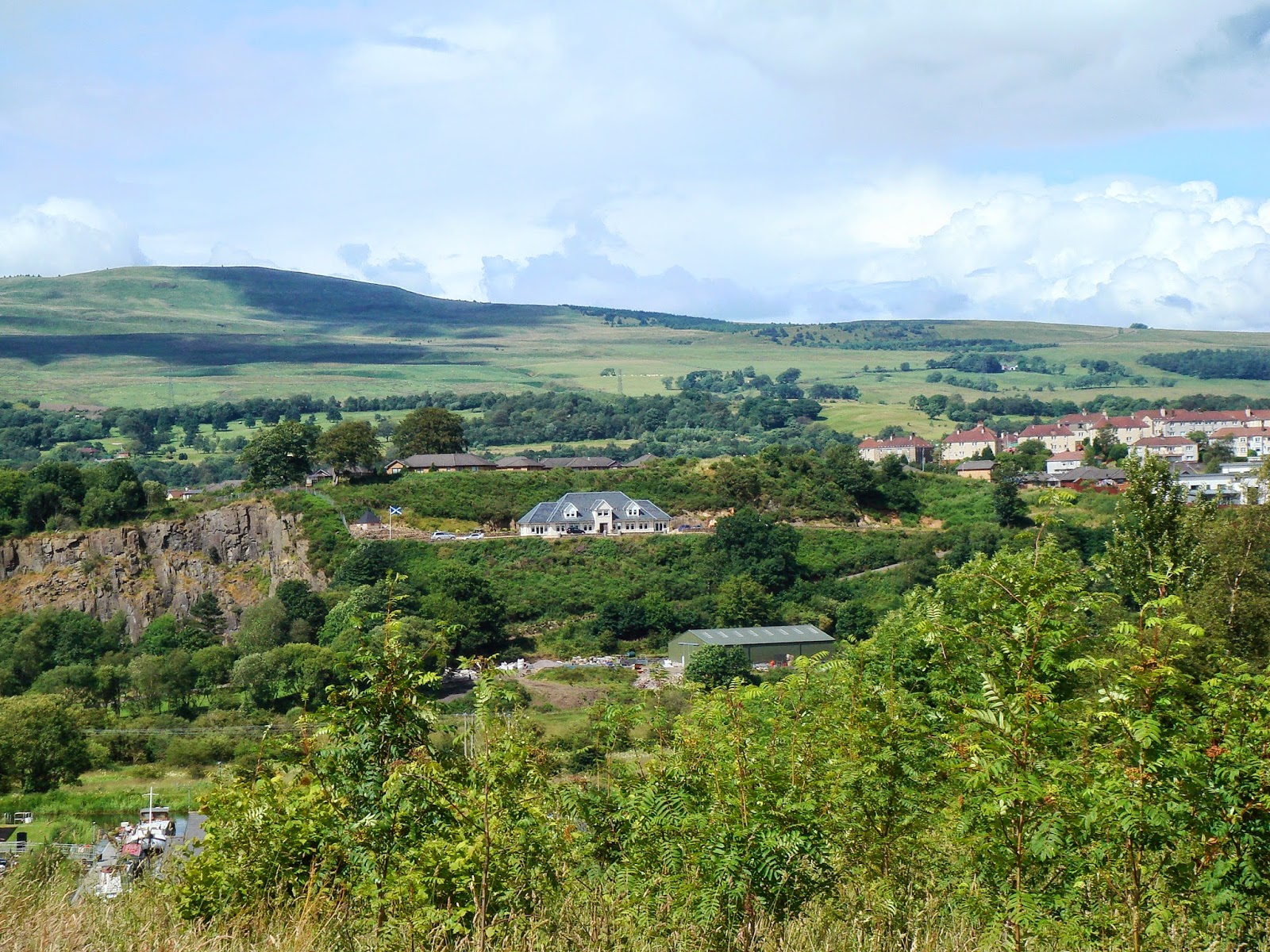
Looking from Nethercroy path over Auchinstarry and Kilsyth to Tomtain. On the very top right of the photograph, where the small copse of trees is, is the summit of the Tak Ma Doon Road and the car-park in the sky. It is from just beyond the car-park that the path to Tomtain starts.

Nearing the summit by the old stone bridge (built 1834)... and Tomtain looming in the background.

From the summit of Tomtain looking north-west, with the Meikle Bin (570m) on the far left and the Carron Reservoir and the Fintry Hills on the right.

Looking north towards Stirling and the Ochil Hills (directly over the route covered in the post 'Flower & Freedom on the Backroad to Bannockburn').

Looking south from Tomtain over Kilsyth in the foreground.
No comments:
Post a Comment