Barrhead Circular via the Kissing Tree & Glenburn Reservoir


Here, it's the small inner circle we're interested in, kicking off from Barrhead Station (blue circle, centre right) heading in a south-westerly direction up into the Fereneze Hills.


This is a great wee route, short, but invigorating, with some stupendous views over the valley. It starts at Barrhead Station and the Gateside Road, which takes us up up up. About 200m into the Gateside Road you'll notice (if you have your eyes peeled) a little road veering off to the right. There is a huge monkey puzzle tree in the garden next to it. The road itself is called Hillside Road, aptly enough, and it's steep!! But, as with all steepness (or is it 'stepth'), there is a payoff when you get to the top. The bonus here is that it's only about a kilometre or so up to the end of the road and onto the wooden staircase which takes us up to Ferenese Golf Course and a walking route round the back of it. After half a kay or so, there is a small path that leads up to the cairn and the kissing tree, and from there it is easy enough to cycle back down via Glenburn Reservoir (round the southern end of it) and the path through the woods beneath the braes which will eventually lead us onto the road back to Barrhead. Even taking your time to inhale those majestic views, and cosmic rocks, it shouldn't take much longer than a couple of hours. But man! what a couple of hours. 


Fereneze Golf Course. Part of the path skirts around the back of the course.


There's a lot to be said for landmarks, and being able to navigate and identify the land by its flow-ers. This tree, for instance, is both a landmark and a flower, and can be seen from miles away as I approach Pollok Country Park from the top of Dumbreck Hill (more or less the westernmost end of Springkell Avenue).


A wonderfully preserved cup & ring greywacke stone on the path between the golf course and the kissing tree. These stones tell me I'm in the right place for a little bit of spacing out!


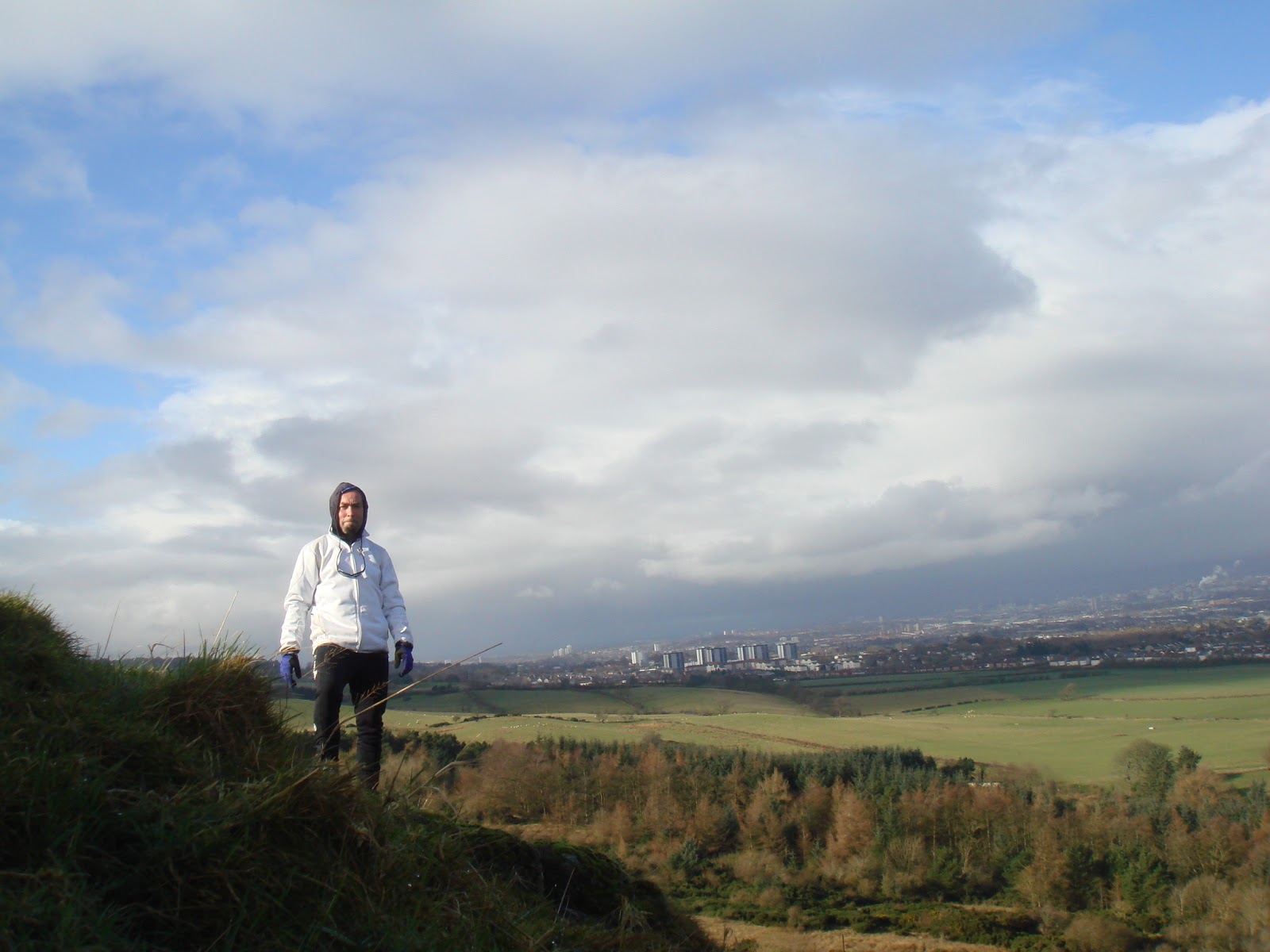
Another fresh day overlooking the valley...


Looking north-west...


The route is pretty well signposted. The only thing I would say is do not go on this little trip after it's been raining as this field here (above) will be a quagmire in places and will require some really deft touches in order to get by. The highland cattle are the least of your worries. Just watch out for that mud!


The Corrie of the Fallen Log


The Kilpatrick Braes are a remnant of the stratovolcanic range that encircles the Glasgow valley to the north. This range includes the Campsie Fells and stretches from Dumbarton in the west to Kilsyth in the east. It is only one of many such ranges all over this part of Scotland's midriff. They are gentle for the most-part, not rising too far above 500m, in fact the highest point in the Kilpatricks is Duncolm at 401m, but there is a quality to them that emerges from this gentleness that higher mountains just do not have. 

Here, as we move up the Loch Humphrey path we can take a detour into the braes themselves via a hidden gate. This takes us up into the braes via steps or terraces of which there are several. Here, you will find not just the corrie of the fallen log, but the sacred waterhole, the original Hillary Step, and many other geological oddities that bring this place to life. It is a marvellous place with waterfalls, and fallen trees. Indeed, it is this fallen-ness that adds to the whole beauty of the place. It is left to its own devices and is largely devoid of any people (they just don't see the hidden gate as they are too focussed on the straight and narrow Loch Humphrey path). But there are deer, buzzards, ravens, all manner of woodland birds, even a great-spotted woodpecker who has recently moved in.... And with those aereating views over the valley and down to the coast, you simply cannot beat this place for stilling the self, and gathering Mind. 

It is one of the great primal perches of the Greater Glasgow Valley.


The man with wheels for arms... atop the Kilpatrick Braes...


The fallen log in question. An exceptional perch if ever there were one. Sadly now, since the Forestry Commission's controlled burning of the bracken (a few weeks after this picture was taken) the log and its immediate surroundings are in no state to be perched upon.


The brae buzzard patrolling its range.


This is the controlled burning which took place on June 2nd. I had actually been sitting right beneath it at the water hole for some 2 hours without noticing anything, protected as I was by the ledge and the brae wall, and of course the wind which was carrying the smoke away to the north. I only noticed this when I was cycling home and saw this from the boardwalk at Braehead. I must say, that without these controlled burnings, much of the braes would be literally impassable due to the veritable jungle that emerges when these ancient ferns decide to club together.


Paisley Canal to Langbank via Bridge of Weir


The clearest way into your Self is cycling through open country back-roads under your own steam! Here, from Bridge of Weir to Langbank we are not only blessed with back roads, car less and carefree, but actual leisure lanes that have been given over to non-motorized traffic: walkers, horses, cyclists... 

To be sure, the six odd miles from Paisley Canal to Bridge of Weir along the sustrans cycle route is carefree enough but it is kinda boring, enlosed for the mostpart by high hedgerows and trees that do not open up the countryside to you. Where, then, the initial part of this route is cycling through closed country (with a few apertures here and there), the second part is emphatically all open as we head to Langbank along East Renfrewshire's leisure lanes and overgrown single track farm roads.


The wonderful conifer-topped Barochan Hill as we briefly exit the leisure lanes and hit the main road for a few hundred metres before nipping back into serenity.


The exposure as we pass by Barscube Hill (to the left) and head down towards the main road is amazing: to the north, the Highlands and the snow-capped beacon hill of Ben Lomond, and as we descend, Dumbarton Rock and the Clyde Estuary become more apparent.


Just makes sure your brakes are working as you come into to Langbank, a lovely 'sea'-side town with an almost Mediterranean feel! The train station is just around the corner for the train back to Paisley or Glasgow.


Paisley Canal Circular via Glennifer Braes


Remarkable!

That's what this little cycle will have you saying if you follow these instructions:

1. Train to Paisley Canal.

2. Turn left, and keep going until you hit serenity in the form of the Glennifer Braes.

3. The main road up into the braes can get a little hairy at weekends with the odd boy racer over-compensating for his own existential disempowerment. So, mind and take the wee cut-off, marked above on the map, that will take you onto the braes (cyclable) and along to Braemount, where you can either head back down to Paisley or continue along to Glen Park.

Et Voila!

A perfectly impeccable two hour cycle. Ideal for a lazy Sunday afternoon.

And those views......  !!!!!!


The Ritual Hills: Epic Dechmont


The train from Maxwell Park to Newton takes 20 minutes. From Newton, Dechmont Hill is all you can see. Another half hour on the bike through quiet backroads and you're there, wondering how on earth such a small hill can reveal such an enormous panorama...


To be honest, I cannot think of many ritual hills that are so close and so accessible, yet so permanently empty and remote. In spite of passing through Dechmont Farm to get to the hill (there's a crumbling path all the way up), I have never seen any human beings here. There is also, at the top of the hill, hidden away in some trees, a small cottage as well. But again, no sign of life. Which suits me just fine. The other day, whilst heading up the Loch Humphrey path to the Kilpatrick Braes I was rather alarmed to see a tour bus ejaculating geriatrics with all the latest Norse walking gear and weather-proof clobber. This is the result of celebrating place: it invariably becomes overrun and spoiled. I am all for the odd impromptu conversation with strangers but when you get groups like this, there are no strangers any more, just a herd mentality that has little strangeness about it at all. This is why I love Dechmont so; because it appears to be impenetrable. No-one really knows about it; no-one really cares about it; and it is sufficiently removed from the train station to discourage walkers. And yet...!


The view over Glasgow from Dechmont Hill. In the lower left, you can see the remains of Gilbertfield Castle, and Gilbertfield Farm. This whole area is a wonderful buffer zone between Cambuslang and East Kilbride, and its spaces like this, whilst probably under-appreciated by most that are the life-blood of the city.

There are several of these hills around Glasgow, which I like to call 'Ritual Hills' for their capacity to restore the spirit after a long and dark winter. I make pilgrimages to them every year, and rejoice every time I do so. From their humble summits I encompass the valley, embrace her, after a short period of absence. I gaze upon the valley and all creatures within her as a single systemic organism. And I rejoice in the clarity I receive in return, the seering serenity that enters from having resided here if only for a few minutes.


Dechmont, then, is just on the edge of Glasgow City proper. And the edge of Glasgow, being a valley, is far more revealing than its centre.


This time, I decided to return via Cambuslang and the River Clyde cycle path instead of round the back of Dechmont and into Carmunnock and Castlemilk.


Another spectacular February day. I cannot recall any February being this sunny.... ever! And the path here is wonderful taking us all the way into the city, and for me, all the way home to Cessnock without ever seeing a car.


Coming into Glasgow Green, the sky still undecided. Showers are on their way, but not before I make it home in one piece and bone dry!

Left the house at 10.20am. Was back for 2.10pm. And all this without ever rushing.


On the Side, not the Summit, of Slackdhu

The Strathblane Hills (at least their south faces) have always intrigued me for their sheer wall stature and their crumbly bone-like nature. Indeed, the word fell, some say deriving from the Old Norse fjiall meaning rocky hill, is perfect for the Strathblane Hills of which Slackdhu is the more prominent. Last year I finally got onto the slopes of Slackdhu, having decided not to go up Dumgoyne for the umpteenth time, and try another hill. To be sure, as the cornerstone to the Campsies, Dumgoyne offers uninterrupted views north to the Highlands, but the views from Slackdhu are no less impressive. Its slopes, too, are far more interesting too than those of Dumgoyne, containing as they do a vast erratic field of boulders and rocks that have been dislodged from their matricial hill.


 Slackdhu and its wall of geology.


All too often, height steers one away from the interesting hills, and though I never got to the summit of Slackdhu, I really didn't need to. Summits, I find the older I get, are simply a form of psychic compensation for those who need it; in other words for those whose lives and living are by and large swallowed up by some blood-sucking nine to five 'job'. The summit then becomes, in the spirit of the superlative-laden capitalist mind, some kind of anti-dote to the disease and unease of modern day living. But it needn't be.

I often find that those who are hell-bent summiteers miss all that glory on the way up for their head-down-ness and their too-much-focus. The spontaneous-minded amongst us however will stop on the side of a hill wherever and whenever the moment arises to do so. Their is no real 'target', no real 'objective'. The summit is simply a summit. It is not a goal. Nor is it the end-point of my living.

Those who judge a hill on account of its height show an alarming lack of imagination, suggesting that it is only the all-round view (which more often than not in Scotland is obscured by clouds) that counts, whilst ignoring the more palatable and intimate aspects of a hill. Where the summit is something of a sledgehammer, the slopes of a hill are a more subtle experience, requiring more attention, and more delicacy, from its hill-walkers. But this is entirely in keeping with a society predicated upon superlatives as the best. Yet, as I have alluded to before, in order to become human, one must distinguish between what is merely big, and what is simply great.

From the slopes of Slackdhu, greatness in the form of budding moss and the inimitable Whangie in the background, a hill of attitude and not altitude if ever there was one!


So the next time you're headed along the Campsie Dene trail towards Dumgoyne, stop at Slackdhu and head up its gentle slopes not to its summit, but to its crumbly rock-strewn bottom. There, in amongst those seemingly motionless great erratics, you might just find part of your Self.


On the side, not the summit!  [February 15th, 2016]


The Great Embrace: Neilston Pad on a Glorious Day in February


This cold February morning, the sunshine pulls me out. I am, after all, a creature of light. It seems that I no longer have to try. I just release my self to Nature and let her take over.

I'm off up to Neilston. It's a short route but absolutely beautiful. And so energizing. To not do it on a day like today would be tantamount to a crime against nature. But that's what modern society appears to be, a crime against Nature writ large.


What a wonderful route to get to the train station!  Through the woods of Pollok Country Park towards Pollokshaws West train station for the train up to Barrhead.


From the train, a wonderful view of the lumps and bumps of Glasgow's southern periphery. Neilston Pad is on the right.


From Barrhead Station just follow the road ahead of you, yes, that one going uphill. This is the beautiful Gateside Road to Killoch Glen and Neilston, and it's always empty.


From atop Neilston Pad....
 

The great walker and writer Theodor Brotchie in his wonderful Some Sylvan Scenes Near Glasgow opens his 18 Afternoon Rambles with a trip to Neilston and its surrounds:

The old-fashioned and still quaint little village of Neilston lies in a straight line about nine miles from the city. Those who still cultivate the art of walking may fix on this upland town as the starting point for a delightful Saturday afternoon's ramble....

The air is keen and bracing, and carries with it the nip of the moors, for Neilston stands high. A beautiful landscape unfolds itself to view as we pause to take breath. We have around us a charming variety of hill and dale, and wood and water, with all their varying local life and colour...

About the pad itself, he writes:

A more wild or beautiful scene cannot be imagined. A perfect panorama of hill and dale, woodland and moor, mountain, loch and sea radiates on all sides from our vantage spot. There are few places in fair Scotland which command such a wide-stretching view.


It's a rousing call, surely...